Manufacturing, Quality Control & Workplace Safety
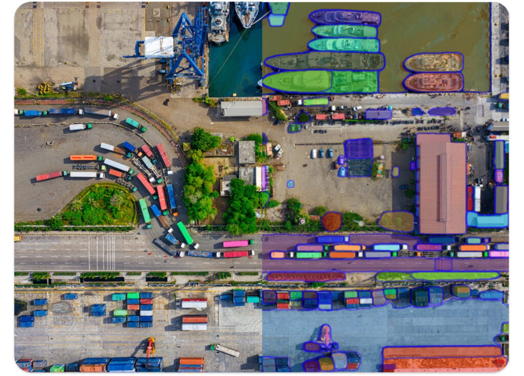
Ensure a secure, efficient, and compliant work environment. Visual AI monitors real-time hazards and automates product counting, packaging checks, and tracking of vehicles and personnel.
Automate tasks with AI
Cut Costs, Boost Efficiency, and Improve Transparency
Incorporating Artificial Intelligence into your production line or surveillance system can lead to substantial cost and energy savings, reduced failure rates and enhanced process transparency.
AI-driven solutions such as image classification, tagging or object detection can be used to automate routine tasks and streamline your workflow.

Automate tasks with AI
Automate Quality Control with Visual AI
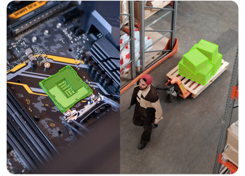
AI is transforming quality control in manufacturing with advanced visual inspection systems. Using image recognition and object detection, AI can identify defects and anomalies more accurately than human inspectors.
This improves product quality, reduces waste, and cuts costs. From electronics manufacturing and semiconductors to wind farms, many industries now use AI for automated inspections, enhancing efficiency and maintaining high standards in both production and maintenance.
Safety & Security
Strenghten Security & Optimize Compliance
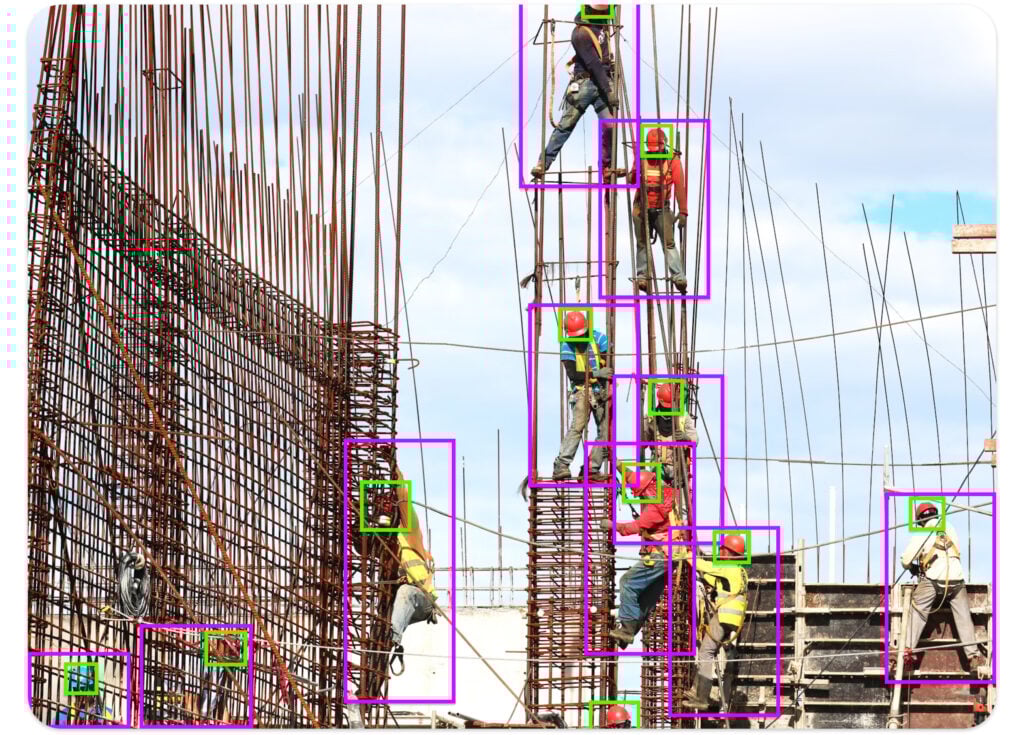
Visual AI enhances workplace safety by monitoring real-time footage for hazards and unsafe behaviours. It alerts staff to potential risks, helping to prevent accidents and ensure adherence to safety protocols.
Tracks access points and detect unauthorized personnel, preventing breaches and suspicious activities. Visual AI helps secure sensitive areas and facilitate compliance with regulations.
Offline AI
Deploying AI Models Offline in Factories
Using visual AI offline in your production or inspection line offers advantages like enhanced control, reduced latency, and improved data privacy without requiring internet access.
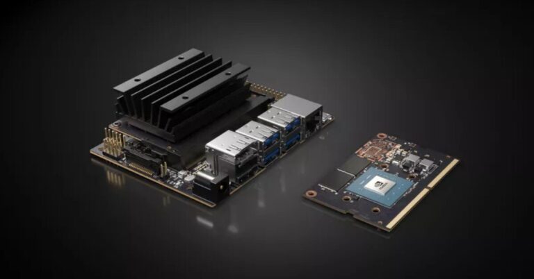
Models can be deployed on modern edge devices, such as the NVIDIA Jetson, which provides real-time processing from camera feeds monitoring your factory’s production line.
Tips & Tricks
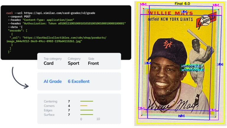
Automate Card Grading With AI via API – Step by Step
A guide on how to easily connect to our trading card grading and condition evaluation AI via API.
How to deploy object detection on Nvidia Jetson Nano
We developed a computer vision system for object detection, counting, and tracking on Nvidia Jetson Nano.

Visual AI Takes Quality Control to a New Level
Comprehensive guide for automated visual industrial quality control with AI and Machine Learning. From image recognition to anomaly detection.
Ximilar is a reliable & responsible partner in image AI. We deliver what we promise.
Contact us now- Easy setup
- •
- Expert team
- •
- Fast scaling